A 15-judge bench at the International Court of Justice (ICJ) has just returned its verdict – in the Court’s Great Hall of Justice – on a maritime territory in the Indian Ocean whose boundary Somalia and Kenya have disagreed on since the 1970s. According to ICJ President, Judge Joan E. Donoghue, the boundary will be a new one. It will also be an adjusted one constructed using “ICJ’s three-stage geographical methodology for constructing a median maritime boundary of the disputed territory to reach an equitable solution.” Its definitive position, she advised, would be arrived at by bilateral agreement or adjudication. Kenya, which withdrew from the case stating she [Kenya] will “no longer be subjected to an international court or tribunal without its express consent,” is fully aware of the ruling’s potential political, socio-economic, and security impact on Kenya and the region. After all, it is an open secret that, in this case, the pursuit of Somalia’s interests in a win-lose situation will violate those of Kenya, and the other way around. Regardless, Kenya has indicated that ICJ’s ruling will be of no consequence to the conduct of her affairs. In other words, ICJ will rule, but Kenya will decide how best to safeguard her national interests. This may involve post-judgement negotiations with Somalia; Kenya has maintained her preference of this option consistently. A negotiated settlement will protect the tumultuous region’s stability, and should be encouraged and pursued.
Somalia filed the case against Kenya at the ICJ in 2014 following failed attempts to settle the matter out-of-court, asking the Court to “determine the complete course” of the shared boundary “including the continental shelf beyond 200 nautical miles,” and “the maritime boundary” that the two share, by international law, using “geographical coordinates of the single maritime boundary in the Indian Ocean.” Somalia, on the one hand, applied the equidistant principle of maritime boundary delineation that sees the boundary running southward. Kenya, on the other hand, applied the parallel of latitude principle that renders an east-running boundary. Delineating maritime boundaries, mind you, is the purview of the Commission on the Limits of the Continental Shelf (CLCS) and the United Nations Convention on the Law of the Sea (UNCLOS). CLCS ensures compliance with UNCLOS regarding the outer limits of the continental shelf beyond 200 nautical miles. However, ICJ can – in deciding cases such as the Somalia vs Kenya one – construct a maritime boundary as Judge Donoghue indicated on October 12, 2021. CLCS has been privy to a 2009 Somalia-Kenya Memorandum of Understanding on the territory of dispute, potential overlaps of claims on the boundary, lack of agreement on the exclusive economic zone, and absence of a bilateral agreement on the shared boundary. Both states are signatories to UNCLOS that they ratified in 1989.
Valuable Resources
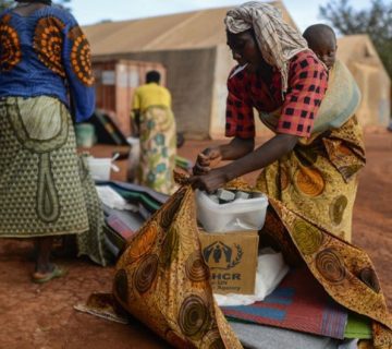
It turns out that the 62,000 square miles (100,000 square kilometers) disputed territory contains two high-value hydrocarbons, gas, and oil, which, in hindsight, both states would like to explore. However, Kenya – an anchor state, and a current non-permanent member of the United Nations Security Council – is more interested in supporting efforts to overcome regional security challenges, providing leadership, and exercising its sovereignty over its territory than in what a part of its territory may or may not contain. That does not mean that Kenya does not care about the territory in question. On the contrary, Kenya is ready to defend her territory, and secure her world renown tourism, and blue economy sectors. Up until now, Kenya has supported Somalia, South Sudan, and other fragile and not-so-fragile states in the region to manage difficult political transitions; hosted their representatives, and displaced populations; and birthed transformative peace agreements. Further, Kenya has invested millions of US dollars in its Indian Ocean port infrastructure which now includes the Lamu Port-South Sudan-Ethiopia Transport (LAPPSET) corridor project. Amid these, Kenya has contributed her troops to ensure the region’s peace and stability, including in Somalia as part of the African Union Mission in Somalia (AMISOM), Sudan, South Sudan, and the Democratic Republic of Congo (DRC), helping to dampen the impact of the activities of Somalia-based terror group, al Shabab, in Kenya and the region. Kenya, arguably, will not sacrifice such hard-earned gains on the altar of a ‘biased’ judicial decision.
A New Boundary
Somalia’s President Mohamed Abdullahi Mohamed has welcomed the Court’s decision to alter the existing lines of claim, and, knowing that Kenya does not accept the ruling, asked the neighboring country to follow suit. President Uhuru Kenyatta, having contemplated ICJ’s ruling, issued a statement saying “… Kenya wishes to indicate that it rejects in totality and does not recognize the findings in the decision. The decision embodies a perpetuation of the ICJ’s jurisdictional overreach and raises a fundamental question on the respect of the sovereignty and consent of states to international judicial processes.”
This situation comes on the back of Kenya’s insistence on her preference for a negotiated out-of-court settlement of the territory of dispute. The countries’ opposing positions threaten to worsen the already tense Kenya-Somalia relations, but also present an opportunity for Nairobi to agree to a negotiation on the definitive location of the shared boundary with Mogadishu. The jury on the form and/or outcome of such a negotiation is still out, but Kenya and Somalia should seize the moment to delineate and delimit a border once and for all without antagonizing each other needlessly, compromising national interests, and/or setting off geopolitical maritime battles that could further destabilize an already unstable region.
Roselyne Omondi is the Associate Director, Research, and Asia M. Yusuf a Researcher at the HORN Institute.
Photo: Kenya Navy Officers on patrol in the Indian Ocean (Photo Credit: Kenya Defence Forces)
The contents of this article are copyright of © The HORN Institute 2022. All rights reserved. Any redistribution or reproduction of part or all of the contents in any form and for whatever reason is prohibited. You may use the content of this article for personal reasons, but acknowledge the website as the source of the material.